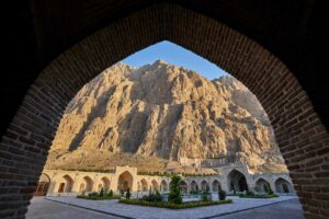
Alam Kuh or Alam-Kuh is a monumental peak, perfect for mountaineers and nature lovers. This is a popular summit that is commonly referred to as the “Alps of Iran” because it combines difficult ascents, spectacular views and a varied ecological environment. Mount Alam Kuh is located in the Takht-e Suleyman massif and is the second-highest mountain of Iran, attracting mountaineers worldwide since the 1960s.
Its northern face has one of the most imposing granite walls in the Middle East, making it comparable with famous routes such as those on K2. Regardless of whether you are planning an Alam Kuh hike or just want to know about its beauty, this guide will explore its geography, trails, weather and more, offering important information to curious adventurers.

Alam Kuh Elevation and Geographical Facts
The Alam-Kuh elevation is exactly 4,848 meters (15,906 feet) above sea level, the second-tallest peak in Iran after Mount Damavand, with 5,610 meters. Alam Kuh, which overshadows the Takht-e Suleyman massif, is a glacial paradise of wonder placed among the 1,515 ultra-prominent mountains of the globe.
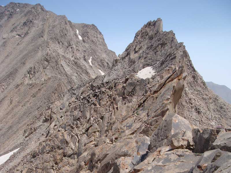
The shape of the mountain is also unique; it is a sharp and pyramid-shaped mountain with very little space on the summit to hold a few climbers, just enough to stand or sit. The mountain has permanent glaciers surrounding it, including Alamchal Glacier on the northern face, which supplies the surrounding area with permanent snow cover and rivers such as the Sardabrud.
Alam Kuh is more technical and less volcanic compared to Damavand, and does not have the sulfur vents on its taller counterpart. Damavand has simple hiking trails, whereas the peak requires rock-climbing skills on its northern wall and is therefore appealing to advanced mountaineers. Both peaks share the Alborz’s alpine environment. However, due to its proximity to the Caspian Sea, Alam-Kuh has more humidity and a higher level of precipitation, which contributes to greater biodiversity.
Where Is Alam Kuh Located in Iran?

Alam Kuh is located within the Alborz Mountains, which form a massive mountain range that extends through northern Iran to the Caspian Sea. To be specific, it lies within the Kelardasht District of Mazandaran Province, which sits 160 kilometers northwest of Tehran. The mountain belongs to the Takht-e Suleyman massif, having 47 peaks that exceed 4,000 meters, along with permanent glaciers and various types of landforms. Alam Kuh, Iran, is positioned at coordinates that approximate 36°22′ N and 51°03′ E because its southern slopes descend towards the dry valleys that border Taleghan and its northern slopes lead into forested areas that reach the Caspian Sea.
The geographical description shows two extreme differences: the southern section displays dry rocky terrain, while the northern valleys display green landscapes that receive water from the ocean to create a special environment that supports plant and animal life. The Alborz mountains act as a natural barrier, separating the arid Iranian plateau from the humid Caspian lowlands, while the peak exists as the central point of this separation.
Access is possible through routes starting at Tehran through the scenic Chalus Road, which is a winding highway passing through forested gorges. Roodbarak or Vandarbon villages located in Kelardasht town are starting points for climbers, accessible by 4×4 vehicles or local transport. These locations are approximately 1,200-1,500 meters above sea level, which provides lodges and supplies. Tracks start there, leading upward, and the road to base camps will take 4-6 hours on foot or by mule.
Alam Kuh Hiking and Climbing Routes

If you are planning to go on a thrilling Alam Kuh hike, remember that the two main hiking paths cater to hikers with different ability levels. The southern route begins from Roodbarak village at 2200 meters and leads through Vandarbon and Hesar Chal, which provides hikers with beautiful vistas because it contains no difficult hiking sections that require expert skills.
The northern route, which begins from Roodbarak, leads hikers to the Alam Chal Glacier at 3850 meters through the Sarchal shelter. Climbers need to bring ropes and crampons to complete this Class 5 technical ascent, which includes ridge traverses and ice fields and international climbers find the northern big wall, which rises 800 meters, to be attractive.
The other available routes lead to nearby mountains, including Siah Kaman and Lashgarak and permit multiple-day hiking routes. All climbers need to obtain permits, which require local mountaineering federations to issue them, while guides provide safety assistance during climbing.
also read: ski tour iran
ROUTES TO THE SUMMIT

Alam Kuh weather conditions establish safe mountain climbing requirements because the region experiences high humidity through its proximity to the Caspian Sea which produces consistent rainfall. Each season presents unique conditions: Spring (March-May) has melting snow and unstable trails (5-20°C base); Summer (June-September) offers stable weather, warm days (15-30°C base, 0-10°C summit), and occasional thunderstorms.
Autumn (October-November) brings dry weather, while temperatures drop, which makes short hikes better, and Winter (December-February) brings extreme cold that reaches -20°C with heavy snowstorms that last 7-10 days. The table presents monthly temperature and precipitation data, which display average weather conditions for the area near Kelardasht at its base elevation of 1,200 meters.
|
Month |
Avg High (°C) |
Avg Low (°C) |
Precipitation (mm) |
|
January |
12 |
6 |
43 |
|
February |
11 |
6 |
61 |
|
March |
13 |
8 |
84 |
|
April |
17 |
12 |
40 |
|
May |
23 |
17 |
16 |
|
June |
27 |
20 |
20 |
|
July |
29 |
22 |
25 |
|
August |
27 |
21 |
35 |
|
September |
24 |
18 |
70 |
|
October |
20 |
13 |
100 |
|
November |
15 |
9 |
100 |
|
December |
13 |
7 |
70 |
Seasonal hazards include avalanches in winter/spring and rockfalls from summer thunderstorms and hypothermia, which occurs throughout the year at high elevations. The best months to climb are July and August, when the weather is most predictable and routes are snow-free.
Essential Gear for Climbing Alam Kuh

Climbers need to prepare for those who want to summit Alam Kuh because the mountain presents unpredictable weather patterns and difficult hiking paths. Here is a bullet list of necessary equipment that climbers require:
- Four-season equipment: climbers need a sturdy tent which can withstand high winds and a sleeping bag which provides warmth at temperatures below -10°C and an insulated sleeping mat and a portable stove which enables them to cook during their multi-day expedition.
- Technical wall equipment: climbers need to use crampons, ice axes, harnesses, carabiners and ropes which are longer than 60 meters, and quickdraws and helmets when traveling through northern routes and crossing glaciers.
- Clothing: Base layers, fleece mid-layers, waterproof jacket/pants, down jacket, gloves, hat, and gaiters form a layered system. The sunglasses provide UV protection and the sunscreen has a high SPF rating.
- Safety: GPS device or map/compass, first-aid kit with altitude sickness meds, headlamp, multi-tool, whistle, and emergency blanket; consider avalanche beacon/probe/shovel in shoulder seasons.
You should bring extra batteries and repair kits. The equipment needs evaluation from a certified guide.
also read: Sabalan Tour
Final Thoughts — Is Alam Kuh Worth Climbing?

Alam Kuh provides an exciting experience to adventurers who want to explore something different from regular hiking. The destination offers visitors a combination of technical difficulties, glacial landscapes and expansive views, creating an experience that matches worldwide famous sites and provides personal development and lasting memories.
The activity requires advanced skills because beginners must complete training first to understand how to handle the mountain’s dangerous nature. The big wall and southern route summiting experiences show why Alam Kuh stands as Iran’s most precious alpine destination.
Our Iran Budget Tours let you see more, spend less, and create memories that last a lifetime.