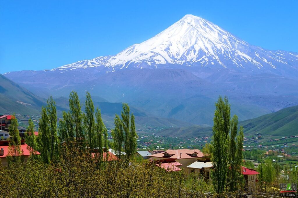
Damavand is the highest point of the great Alborz chain that separates the Caspian Sea from the Iran plateau. It stands out very high, with its elegant cone shape, in the Lar National Park, about 70 km northeast of Tehran, the capital of Iran. With its 5,610 m, this volcano is the highest point in Iran and the entire Middle East.
As a volcano, Damavand is a dormant but potentially active giant, as can be seen from the sulphurous emissions released from some fumaroles near the summit. Its natural features include snow-capped peak, rocky slopes, steep cliffs, natural glaciers, and hot springs, which add to the area’s appeal.
At an altitude of 5610 meters, reaching the top of Mount Damavand is an exciting challenge for mountaineers. This climb requires physical endurance, proper flexibility and climbing skills, making it a popular destination for adventure seekers from all over the world. As the reward for climbing Damavand to the summit, a spectacular view of the surrounding Alborz Mountains, a wonderful view of the Caspian Sea and Tehran, the capital of Iran, gives you the good feeling of “it really worth my effort”.
Characterized by its conical shape and volcanic activity, Damavand is considered the abode of mythical creatures and a symbol of purity and power according to ancient Iranian mythology. Whether you are trying to conquer its highest peak or simply admire its beauty from afar, Mount Damavand is a landmark that shows Iran’s wonders and cultural heritage.
There are 16 routes to climb Damavand Peak, but only four are considered the main routes. Many of the routes now have shelters and provide directions for climbers, making the journey more accessible. To reach the peak, travelers must journey to Damavand city. There are 4 main routes to climb the peak:
- Southern Damavand Flank Route: Starting from the villages of Polour and Rineh, Damavand southern trekking route is the easiest and busiest route to climb Damavand Peak. The hiking trail starts from Gosfandsera.
- Northern Damavand Flank Route: Starting from the village of Nandel, Damavand northern trekking route is the most difficult climbing route. There are two shelters at 3900 meters and 4700 meters.
- Northeastern Damavand Flank Route: Starting from the village of Gazanak, Damavand northeastern trekking route is the most beautiful route through which you can experience watching the sunrise and the beautiful view of the Yekhar Glacier. The route from this flank goes to Takht Fereydon shelter (4300m) and finally reaches the Peak.
- Western Damavand Flank Route: Starts from Abali city, Damavand western trekking route starts at the altitude of 3300 meters. At the altitude of 4200 meters Simorgh shelter, a two-story shelter with a capacity of about 20 people is located. You can trek to the peak by following the path at the back of the shelter. This route is difficult and is recommended to be followed by the professional climbers.
- June to September (Summer): This is the most popular time for climbing Damavand. The weather is generally mild, with warmer temperatures at lower elevations. The trails are mostly clear, and the summit can be reached without encountering excessive snow. However, it’s still important to be prepared for changing weather conditions and bring appropriate gear.
- October and November (Autumn): During these months, the weather starts to cool down, and there is a possibility of encountering snow and colder temperatures, especially at higher elevations. It is recommended to check weather forecasts and be prepared for potentially more challenging conditions.
- December to February (Winter): Climbing Damavand in winter is considerably more challenging and requires advanced mountaineering skills. The weather is harsh, with extremely cold temperatures, strong winds, and heavy snowfall. It is only suitable for experienced climbers with proper equipment and knowledge of winter mountaineering techniques.
- March to May (Spring): Similar to autumn, spring can also have variable weather conditions. There may still be snow on parts of the climb, and the weather can be unpredictable. It is important to be prepared for changing conditions and have the necessary equipment.
All about Damavand South Route
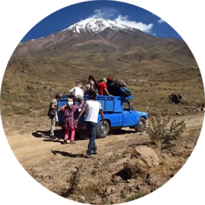 | Accessibility and Popularity: The route starts from Polour village is easily reached by road, making transportation and logistics simpler. Due to this, Damavand southern route is popular among climbers, creating a lively atmosphere with fellow trekkers. This popularity can be beneficial for climbers seeking support, information exchange, and a sense of camaraderie during the trekking. |
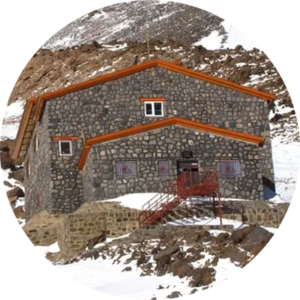 | Well-developed infrastructure: Damavand southern flank features well-developed infrastructure, including mountain shelters, campsites, and emergency support, providing accommodation, basic supplies, and assistance. |
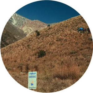 | Clear and marked trail: Damavand south route offers a well-maintained path with clear markings, reducing navigation complexities for trekkers. This ensures that climbers can easily follow the trail without getting lost or facing significant obstacles. |
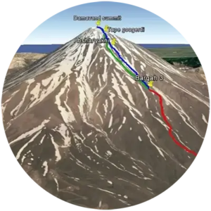 | Moderate difficulty and gradual ascent: The southern route is suitable for climbers with different skill levels, including both seasoned climbers and beginners with good fitness levels. It has less technical difficulty compared to other routes, allowing for a manageable ascent. The gradual slope of the route also facilitates better acclimatization to the altitude. |
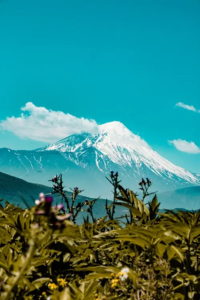
The highest volcano in Asia invites you to a great trip
The first step in planning to climb Damavand is Iran visa application. The process is easy and we can assist you. The necessary documents include a completed visa application form, a valid passport, and passport-sized photographs. We will keep you informed about the progress and guide you through any additional requirements.

Mount Damavand is located in the Alborz Mountain Range in northern Iran. It is 70km far from Tehran, 60km from Amol and 25km from Damavand city.
- Normal physical conditions and fitness
- Experience in climbing up to 4000 meters
- Special climbing conditions and equipment are necessary for winter ascent
Read also: All to know about Mount Alam-Kuh
August is the best time you can climb to the peak without special equipment. However, there is the possibility of sudden weather changes and snowfalls, even in summer.
Read also: Discovering the beauty and rich history of Iran’s Alborz Mountains.
| Warm clothes Hiking boots Gaiter Sunglass Sunscreen cream Climbing pick | Trekking pole Gortex Polar sweater Head Light Personal medicament |
Preparing for a climb up Damavand requires careful training and preparation to ensure a safe and enjoyable experience. This involves focusing on cardiovascular fitness, strength training, and endurance. Activities like jogging, hiking, and cycling improve cardiovascular endurance, while exercises such as squats, lunges, and planks build necessary strength in the legs, core, and upper body. Acclimatizing the body to lower oxygen levels through long-duration hikes and spending time in high-altitude areas is crucial. For technical routes, learning basic mountaineering skills like using crampons and ice axe techniques is essential. Mental preparation through visualization, meditation, and positive self-talk is also important. Consulting with experienced climbers or local guides familiar with Damavand is highly recommended for tailored advice.
If you plan to climb the Himalayas, Damavand is a good practice. While both the Himalayas and Mount Damavand offer exceptional climbing experiences, it is valuable to climb Damavand before attempting the Himalayas. It allows you to gain experience in ascending a significant peak at a high altitude, which can help familiarize you with the physical demands, acclimatization process, and potential altitude-related issues you may encounter in the Himalayas. Additionally, climbing Damavand provides an opportunity to assess and further develop your skills, physical fitness, and ability to cope with high-altitude environments.
Climbing Damavand presents several potential altitude-related challenges, including acute mountain sickness (AMS), hypoxia, cold temperatures, altitude-related illnesses, physical exertion, unpredictable weather conditions, and the need for navigation and route finding skills. As the highest peak in Iran, Damavand’s rapid ascent to high altitude can lead to AMS, while decreased oxygen levels may cause hypoxia. Cold temperatures and unpredictable weather conditions can also pose risks to climbers. Additionally, the physical exertion at high altitudes and the need for navigation skills add to the challenges of climbing Damavand.
When climbing Damavand, climbers have a range of accommodation options. Mountain huts are a popular choice, providing basic facilities such as dormitory-style bunk beds, shared bathrooms, and communal dining areas. These huts are strategically located along the southern route and are managed by the Iranian Mountaineering Federation. At the same time, there are shelters available at other routes.
Alternatively, climbers can opt for campsites, where they can pitch their own tents and enjoy a more immersive outdoor experience. These campsites typically have limited facilities, including basic toilets and water sources.
In nearby towns and villages like Polur, Rineh, or Larijan, hotels and guesthouses are available that offer comfort and amenities, such as private rooms, hot showers, and meals. There are hot springs where you can relax after a successful climb to Damavand.
It is advisable to make reservations in advance, particularly during peak climbing seasons, and to research the specific route you plan to take for available accommodations in that area.
A Damavand climbing permit is generally required and is issued by the Iranian Mountaineering Federation (IMF). It grants permission to climb the mountain and ensures that climbers adhere to the regulations set by the local authorities. It costs about $50.
There are numerous local mountaineering agencies in Iran with extensive knowledge and experience in guiding climbers to the summit of Damavand safely and efficiently.
As a professional tour operator specializing in Damavand expeditions, we at Irun2Iran offer comprehensive services to ensure a safe and memorable climbing experience. With our expertise in organizing logistics such as transportation and accommodation, and arranging necessary permits and paperwork, we understand the unique challenges and requirements associated with climbing Damavand.
A seven-year-old boy from Mazandaran, Iran, has set a record as the youngest person to climb Mount Damavand, the highest peak in Iran. Despite this achievement, it is generally advised that children do not attempt such high-altitude climbs until they are at least twelve years old, due to the risk of altitude sickness. The symptoms of altitude sickness can be more dangerous for children, making it important to consider their safety when planning mountain expeditions. It is recommended that children under seven years old do not climb above 3,000 meters, while those aged seven to twelve can climb up to 4,000 meters with caution and those above 12 can climb up above 4,000 meters.
Yes, if you have little climbing experience, it is recommended to be accompanied by a skilled guide. The experienced Damavand guides know the routes, weather and safety conditions, they can guide you along the way and help in case of any problems. Damavand guides are usually prepared with the necessary equipment and facilities for emergencies and can perform emergency measures if needed.
However, climbers with enough climbing experience who are familiar with the routes and conditions of Mount Damavand may fulfil the mission without a guide. In any case, always consider your safety on top of everything and stick to the safety rules of climbing Damavand to the summit.
To successfully climb Damavand, it is essential to practice physical fitness and develop strong leg muscles. In addition to engaging in sports, it is crucial to have experience in mountain climbing so that you don’t get into trouble at the height of 5610 meters of this mountain.
As acclimatization practice, you can try the high peaks of Sablan and Alam Kouh, which are about 4800 meters high, so that your body gets used to the lower air pressure and reduced oxygen levels experienced at Damavand.


